A rare volcanic tornado, known as a "volnado," formed at the Kilauea volcano on Hawaii Island on June 14, 2026 [1].
This event highlights the volatile interaction between extreme geothermal heat and atmospheric conditions, creating a dangerous localized weather system. The phenomenon occurs when the intense heat of an eruption triggers rapid air movement, potentially complicating efforts to monitor volcanic activity.
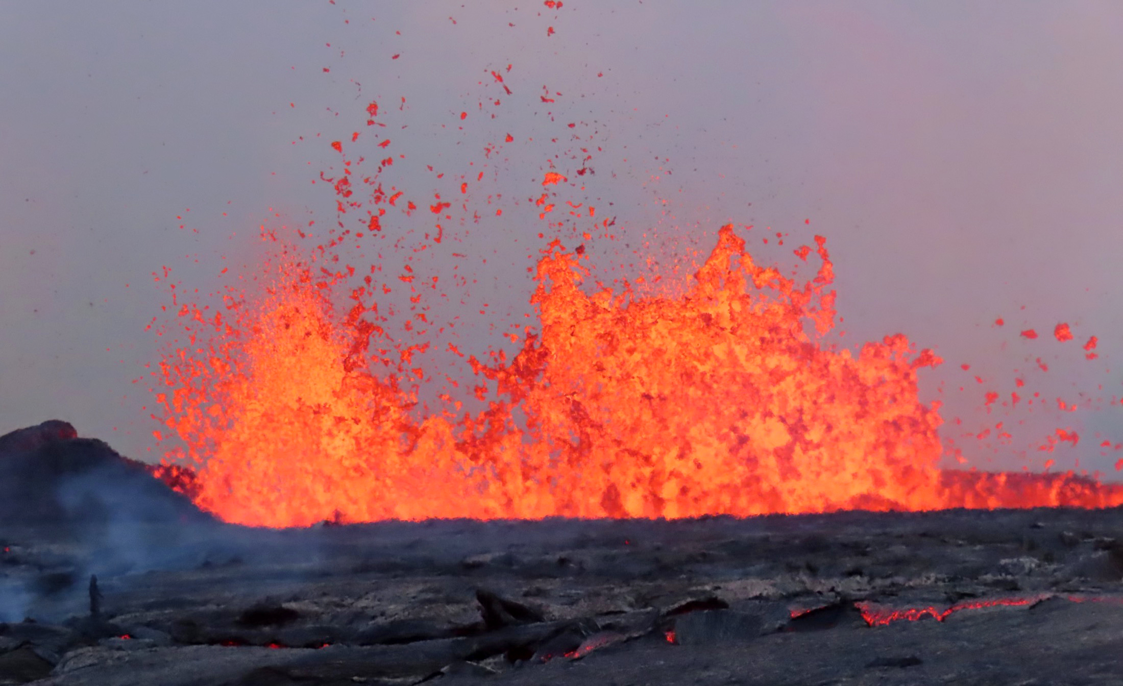
Surveillance cameras captured the moment a lava column and a massive swirling pillar of wind occurred simultaneously [1, 2]. The footage shows pebbles and sand being swept upward into the vortex [1, 2].
The U.S. Geological Survey (USGS) said the tornado formed because air heated by the lava rose rapidly, drawing in cooler surrounding air to create a powerful updraft [1].
Kilauea has been active intermittently since December 2025 [1]. By the date of the volnado, the volcano had recorded 49 eruptions [1].
Reports on the timing and scale of recent activity vary. While some records cite the volnado on June 14, other reports listed eruption activity as early as June 9 [2] or June 10 [6]. Additionally, some reports said that lava columns reached heights comparable to the Empire State Building, approximately 381 meters [6].
“A lava column and a massive swirling pillar of wind occurred simultaneously.”
The emergence of a volnado underscores the complex synergy between volcanology and meteorology. While these events are rare, they demonstrate how volcanic eruptions can act as localized heat engines capable of altering immediate weather patterns. For scientists and residents in Hawaii, this emphasizes the need for integrated monitoring systems that track both seismic activity and atmospheric shifts to predict sudden, hazardous wind events during eruptions.


